
Tornado touches down in Voyageurs National Park
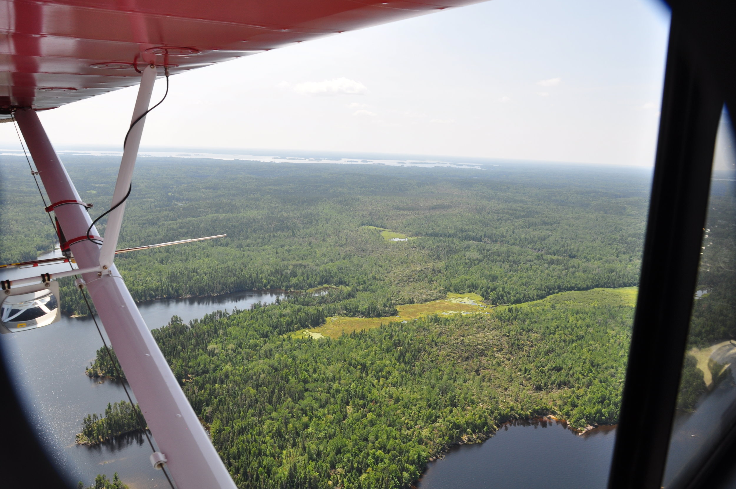
Photo taken from NPS aircraft looking south from Marion Bay towards Locator Lake. The 200-600 yd swatch of the tornado can be seen as a light brown color against the green background of the standing forest (National Park Service)
Around 8:06 pm, July 17, 2019, a confirmed tornado with video documentation touched down in the Kabetogama Peninsula of Voyageurs National Park, causing significant damage along an approximately 2.5 mile path between Locator Lake and Marion Bay, Rainy Lake. The tornado was part of a larger cell of storms that passed through the area at that time. The National Weather Service office in Duluth, MN estimated the tornado as an EF-1 strength tornado with maximum winds of 100 MPH. Additional information about the tornado can be found here.
Aerial reconnaissance on July 24 confirmed the extent of this extreme weather event, the first confirmed tornado touchdown in the park’s 44-year history. Straight-line wind events that resulted in downed trees are more common in the northern part of Minnesota, with the most noteworthy such event being the 1999 blowdown event in the Boundary Waters Canoe Area Wilderness that flattened nearly 500,000 acres of trees.
“Wind and fire are among the natural forces that shape our forests,” said Steve Windels, a wildlife biologist at Voyageurs National Park. “Even though this particular tornado only affected less than 500 acres of trees, it will result in the regeneration of young forest which is important habitat for species such as moose, forest grouse, songbirds, and other wildlife.”
“We are seeing more extreme weather events in our area.” said Windels. “Often accompanied with high rainfall amounts in summer storms. We’re not sure if this also means a higher likelihood of things like tornados in our future.”
Most of the downed trees occurred in aspen-dominated stands or within a black spruce bog, and the likelihood of future fires related to this event is low or will be of a minor scale, according to fire management officials at Voyageur National Park.
Voyageurs National Park staff are working with forest ecologists in the National Park Service’s Inventory and Monitoring Network based out of Ashland, Wisconsin to learn more about this rare natural phenomenon. They have requested higher resolution satellite imagery of the area to better quantify and map the affected area. The continued monitoring of the location, size, and severity of these disturbances will provide insight into what the disturbance regime in the future may look like.
Most of the damage that occurred is within the Proposed Wilderness Designation for Voyageurs National Park where few visitors ever venture, but a portion of the Locator Lake trail and a few houseboat mooring sites on Marion Bay, Rainy Lake were affected. Downed trees across the Locator Lake Trail were cleared and the trail is open for use. The Marion Bay West (R41) designated houseboat site continues to be closed due to the number of trees down in the area. The park hopes to have the site cleared and opened within a few weeks.

Map depicting estimated route of the tornado through the Kabetogama Peninsula, Voyageurs National Park (illustration by NPS staff).
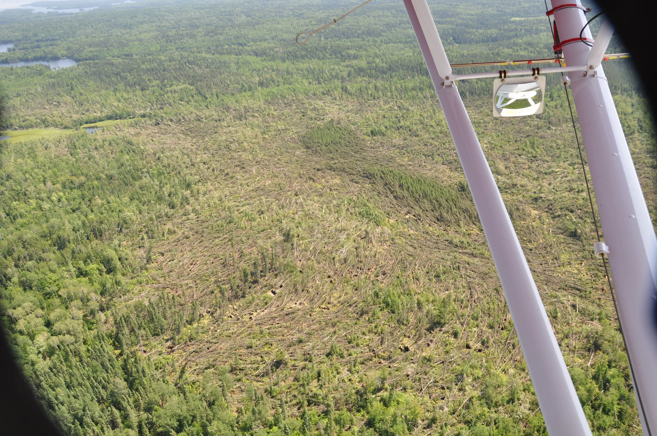
Close-up shot of tornado damage, showing circular pattern of downed trees that is typical in tornado events