
All winter trails within the park are now open. Snowshoes and cross-country skis are available from the Rainy Lake Visitor Center (see details below).
Snowmobile portages are groomed. Full grooming on lake surfaces will occur as ice conditions allow. Conditions on frozen lake surfaces are rough. Snowdrifts have frozen and create hazardous conditions off-trail. Use caution at night and during low visibility.
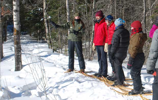
Snowshoes and cross-country skis are available from the Rainy Lake Visitor Center (see details below).
Snowmobile portages are groomed. Full grooming on lake surfaces will occur as ice conditions allow. Conditions on frozen lake surfaces are rough. Snowdrifts have frozen and create hazardous conditions off-trail. Use caution at night and during low visibility.
The Rainy Lake Ice Road is open from the visitor center to Cranberry Bay, and around portions of Dryweed Island. The Kabetogama Lake Ice Road is now open from the Kabetogama Lake Visitor Center Boat Launch to the Ash River Visitor Center Boat Launch.
Ski trails are open, packed, and tracked. Conditions are fair to good. Snowshoe trails are open, but not packed.
Please remember the snowmobile speed limit within the park is 45 mph on frozen lake surfaces and 25 mph on all overland portages. Speed limit signs are posted at trailheads and portages. The speed limit for the ice road is 30 mph.
When ice fishing, please remember holes must be drilled at least 50 feet from ice roads and snowmobile trails. To reduce hazards to snowmobile users, all ice blocks are to be immediately chopped up, submerged, or hauled to land. Placement of equipment or any type of structure must be greater than 50 feet off the edge of all ice roads and 50 feet off the centerline of all snowmobile trails. Written authorization from the park is required for individuals to plow greater than 300 feet on any lake surfaces within the park.
The Rainy Lake Visitor Center is open Wednesday through Sunday, 10:00 am to 4:30 pm. During business hours, the visitor center offers maps, information, and hot cocoa. Visitors may borrow snowshoe and cross-country skis, but must be returned the same day.
The most up to date winter trail conditions are available at www.nps.gov/voya.
Snowmobile Trails
- International Falls to Kettle Falls (Purple Trail) – Open and staked
- Rainy Lake/Black Bay to Kabetogama Lake to Ash River (Green Trail) – Open and staked
- Ash River to Crane Lake (Green Trail) – Open and staked
- Chain of Lakes (Dashed Black Trail) – Open and staked
- Ash River to Kettle Falls (Yellow Trail) – Open and staked
- East Namakan Lake to Sand Point Lake (Blue Trail) – Open and staked
Ice Roads
- Rainy Lake Ice Road – Open to Cranberry Bay, and around portions of Dryweed Island
- Kabetogama Lake Ice Road – Open
Ski Trails
- Echo Bay Ski Trail – Open, packed, and tracked
- Black Bay Ski Trail – Open, packed, and tracked – Pine Loop rocky in places.
- Tilson Connector Trail – Open, packed, and tracked
- KabAsh Trail – Open
Snowshoe Trails
- Black Bay Beaver Pond Trail – Open, not packed
- Blind Ash Bay Trail – Open, not packed
- Oberholtzer Trail – Open, not packed
- Sullivan Bay Trail – Open, not packed
“STAKED TRAILS MAKE SAFETY SENSE”
ORANGE IDENTIFIES HAZARDS

